
John McDouall Stuart was one of the greatest explorers of inland Australia.
Stuart led the first successful expedition to cross the Australian mainland from south to north and return, through the centre of the continent.
The Stuart highway is named after him
John McDouall Stuart (1815 - 1864)
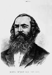
Image WikiCommons
John McDouall Stuart (1815 - 1864) was born on 7 September 1815 in Scotland. After he finished school he graduated as a civil engineer and worked for a while as a clerk in a shipping office. At the age of 23 he sailed from Scotland to South Australia, arriving in January 1839. Adelaide had been established just two years earlier and was an isolated settlement of tents and thatched wooden huts with earth floors. Captain Charles Sturt was the Surveyor-General and he employed Stuart in the Survey Staff. However, in 1842 Stuart lost his job so he started work as a private surveyor.
Together with James Sinclair, who had come to South Australia on the same ship, he began sheep farming in the Mount Lofty Ranges.
Stuart surveyed land for clients in the Flinders Ranges and Gawler Ranges, land that Eyre had explored years earlier and had concluded then that these were barren areas. But Stuart found that with good rain these places were actually excellent land for grazing and his clients, including William Finke, bought land there. William Finke, after whom the Finke River was named, was a wealthy man and he provided the money for Stuart's expeditions.
In 1844, Stuart joined Charles Sturt's last expedition into the interior of Australia. This expedition brought them the closest of any other Europeans to the centre of Australia. After this, Stuart was filled with desire to cross the continent. By the end of the expedition, Stuart had become the second in command. Both Sturt and Stuart were suffering from scurvy, a disease caused by lack of vitamin C, on their return. Stuart was ill for more than a year, during which time he moved to Port Lincoln to live in a bush environment.
The first expedition
Departed 14 May 1858
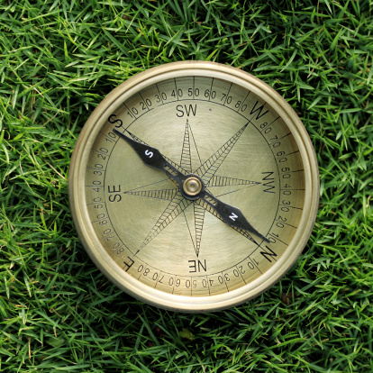
Stuart's instruments included a compass ©Getty Images
Stuart left Oratunga Station, owned by James Chambers, in the Flinders Ranges, aiming to search the north-west of South Australia for minerals and new lands suitable for grazing. He was also searching for a land which the aborigines called Wingillpin. With Stuart was a man called Forster and an Aboriginal man whose name is not known. They took a few horses and enough supplies for one month. Stuart's instruments were a pocket compass and a watch.
On June 26 1858 Stuart made an important discovery; a large creek with 'permanent waters', which he named Chambers Creek. Located in the dry area south west of Lake Eyre, the creek has now been renamed Stuart Creek.
The expedition then travelled north-west but, near what is now Coober Pedy, turned south-west because the stony ground was painful for his horses to walk on. Stuart did not realise that beneath them were the huge deposits of opal for which the region is now famous. They travelled through the eastern edges of the Great Victoria Desert. It was a difficult journey and supplies were running low. However, on 16 August 1858 they arrived at Miller's Water on the coast, west of Denial Bay.
After a four month long journey covering about 2,400 kilometres, the expedition arrived home on September 11, 1858. He was recognised as a remarkable explorer and bushman and was honoured by the presentation of a gold watch by the Royal Geographical Society .
The second expedition
In October, 1858, Stuart applied to the government to lease the Chambers Creek area for sheep farming. To speed up the processing of his application, he volunteered to survey this area himself rather than wait for the government surveyors to do so. Therefore, Stuart's second expedition, from April to July 1859, was to survey his selected area at Chambers Creek. He was accompanied by three men and fourteen horses. After completing the survey , he explored to the north-west and discovered valuable country near South Australia's northern boundary, which he described as 'wonderful country, scarcely to be believed'.
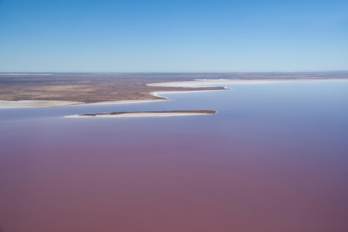
Stuart explored Lake Eyre © Getty Images
The third expedition
Departed August 1859
A prize of 2000 pounds was offered by the government to the first European to cross the continent, forming a route for a telegraph line from Adelaide to the north coast. Stuart was fully determined to achieve this. His friends Chambers and Finke proposed an expedition led by Stuart, but instead the government selected another expedition led by Alexander Tolmer. This expedition set off, but failed soon after.
Stuart's third expedition left Adelaide to re-survey his land at Chambers Creek. Stuart was accompanied by William Darton Kekwick, two other men, and twelve horses. Stuart completed his own survey, then surveyed some additional claims for his friends Chambers and Finke. Stuart then explored the Lake Eyre region and managed to establish the northern edge of the lake. Now known as Kati-Thanda Lake Eyre, it is a vast expanse that is for most of the time a flat salt plain but every ten or so years it is flooded. During that time, the lake is an amazing place, teeming with life.
He discovered new springs fed by waters of the Great Artesian Basin, many creeks and grasslands. The expedition returned to Chambers Creek, but two of the party did not wish to continue. Kekwick travelled south to find replacements, and returned with one man, Benjamin Head.
At this same time, in the colony of Victoria, the Burke and Wills Expedition was preparing to set off in an attempt to cross the continent from the south to the north. No expense had been spared for this expedition, including the importing of camels from India.
Read about the Burke and Will expedition 1860 on kidcyber here.
The fourth expedition
Departed 2 March 1860
With William Kekwick, Benjamin Head and accompanied by thirteen horses, Stuart left Chambers Creek and travelled north. This expedition saw and named Chambers Pillar, the Finke River, and the James, Waterhouse and McDonnell Ranges. They were the first Europeans to see the centre of the continent, crossing from South Australia into what is now the Northern Territory.
On 22 April 1860 they reached the actual geographic centre of the continent. Stuart and Kekwick climbed a mountain that Stuart named Mount Sturt after Charles Sturt. It is now called Central Mt Stuart. Stuart and Kekwick built a cone of stones and raised the British flag. Inside the cone of stones, they placed a bottle containing a note about their arrival.
On June 1860 they arrived a little way north of what is now Tennant Creek, about 2400 kms from Adelaide. Supplies, including water, were running low. The men and their horses were in a poor condition. They were attacked by the local Warramunga people and turned back. That place is now called Attack Creek.
On 20 August 1860 the expedition arrived at Freeling Springs. They managed to shoot and eat a swan.
That same day in Melbourne, Burke and Wills were farewelled by thousands of enthusiastic people as they set off in their attempt to cross the continent from south to north.
On his return to Adelaide, Stuart was celebrated and honoured as one of the greatest explorers. For his achievement in discovering what was in the centre of Australia, he was awarded a special gold medal called the Patron's Medal by the Royal Geographical Society in London.
People in Victoria disbelieved Stuart's claims. They said it was impossible to travel so far north in the time he did, and that he either miscalculated or lied about the latitude of where he was.
The South Australian government still wanted a route for the overland telegraph between Adelaide and the north coast. It offered Stuart 2500 pounds to lead an expedition that was larger and better equipped than the one of Victorian Burke and Wills, thus starting a race between them.
The fifth expedition
Departed 1 January 1861
Together with twelve men and forty-nine horses, Stuart left Chambers Creek. It was extremely hot and some of the men were badly affected by the heat. Stuart left two behind and continued north with ten, making slow progress as they continually searched for water and food for the horses.
On 11 February 1861 Stuart's expedition camped at Coglin Creek near South Australia's northern border.
Burke and Wills were approaching the tidal waters near the Gulf of Carpentaria.
While Kekwick remained in charge of the main camp, Stuart and a small group looked for ways to cross the desert and reach Victoria River. They made many attempts, and searched for water as they went. This was a hard task and Stuart's health became weakened. About 240 kilometres north of Attack Creek, Stuart saw and named Newcastle Waters. Stuart turned back at this point, because the men and horses were in poor condition and supplies were very low. He named a creek Burke's Creek in honour of his fellow explorer.
Meanwhile, at about that time, the only survivor of the Burke and Wills Expedition, John King, was found by a search party led by Alfred Howitt.
The sixth expedition
Departed 8 January 1862
This expedition led by Stuart was financed by the South Australian Government. Stuart was to return to Newcastle Waters but was then was to continue north to the headwaters of the Adelaide River, and follow it to the sea at Escape Cliffs.
Again with William Darton Kekwick as second in command, the expedition left Chambers Creek. Three months later they reached Newcastle Waters, and rested for a few days before starting the crossing of Sturt's Plains, which had caused them to turn back previously. Once again Stuart made scouting trips ahead of the main party and in doing so discovered a number of creeks and rivers which he named after his companions.
On 24 July 1862 they arrived at the ocean at Chambers Bay, near today's Darwin. Stuart had achieved his dream of crossing the continent.
The British flag was raised there. The expedition retraced their steps on the 3400 kilometre journey back to Adelaide. It had been a hard journey and men and horses were exhaused. Stuart's eyesight failed and his health was so bad that he didn't think he'd make it back. One of the party, the blacksmith, named McGorrey, made a stretcher for Stuart when he could no longer ride. The stretcher was carried for about 950 km between two horses. His men were devoted to him and their care saved his life. They arrived back in Adelaide on 17 December 1862.
On 21 January 1863 marked Adelaide's 26th anniversary of European settlement and there were celebrations to mark the occasion. John McDouall Stuart led his successful expedition down King William Street, as the crowd cheered. The expedition had crossed Australia along its centre, south to north, and had returned safely, something many people had thought impossible. This route is now the Stuart Highway, linking Adelaide with Darwin.
Stuart returned to England, sailing from Port Adelaide in April 1864. He died at the age of 50 on 5 June 1866 and was buried in London.
Why is Stuart’s work important?
As a result of John Stuart's explorations:
The western border of South Australia was moved to its current position
The geography of the centre of Australia became known
Control of the Northern Territory was transferred to South Australia
The Overland Telegraph Line, linking Adelaide to Europe via Darwin, was constructed along his route
The original Ghan train route from Adelaide to Alice Springs followed his route
South Australia established a settlement on the north coast at Darwin
Huge areas of the north were opened up for pastoral and mineral development
How is Stuart remembered?
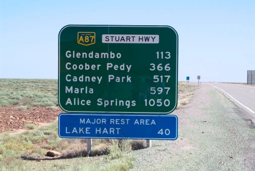
The Stuart Highway, also known as 'Explorer Highway, starting at Port Augusta in the south and going north for 1227km to Alice Springs. © Getty Images
Geographical features named in his honour.
A statue in Victoria Square, Adelaide.
Memorials and plaques in South Australia and the Northern Territory.
It’s a good idea to get information from more than one source!
See some maps of Stuart's journeys and photos of some of the places he discovered
http://johnmcdouallstuart.org.au/first-five-expeditions
Read more about John McDouall Stuart, explorer of Australia
http://adb.anu.edu.au/biography/stuart-john-mcdouall-4662
https://kids.kiddle.co/John_McDouall_Stuart
What is so exciting about Kati-Thanda Lake Eyre when it is full? Read to find out!
https://www.kidsnews.com.au/geography/birds-pilots-tourists-and-nasa-watching-kati-thandalake-eyre-fill-for-the-first-time-in-40-years/news-story/59d4e5b04c761e2888fbd387acb8e3d5